
|
Much of the Republic of Palau is recognized as a protected area, both by its own inhabitants as well as outside organizations. This map (right) displays the many sites that are protected and managed by multiple environmental organizations working together to keep the environment thriving. The coastal areas are a closely monitored area, but the rare forests that cover the islands are equally important to the island and must be monitored as the marine areas are. Maps (top right & left) are courtest of : http://www.palauconservation.org/cms/index.php/conservation-programs/conservation-and-protected-areas/protected-areas |
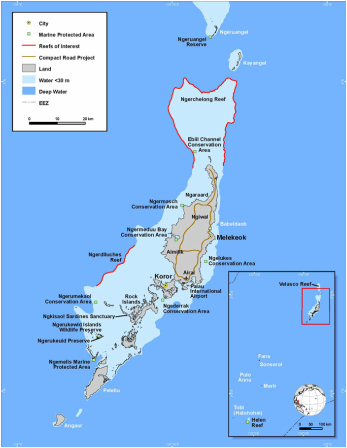
This map of Palau (top) highlights the location of the Ngederrak Conservation area tht monitor the major barrier reefs off of the Palauan coast. Adapted from “The State of Coral Reef Ecosystems of Palau” published by the U.S. National Oceanic and Atmospheric Administration (2005).
|
|
This map (left) demonstrates the extent of forest on Palau, it proves that the people of Palau are dedicated to protecting their island as this displays almost total coverage, represented by green.
Although almost impossible to distinguish, the blue color that is at the bottom of the major land mass on the Eastern side represents the total forest gain since 2000. While the equally tiny red area in the Western bay area shows the total forest loss since 2000. Thankfully, this is hard to see because this signifies that the island is being monitored well. 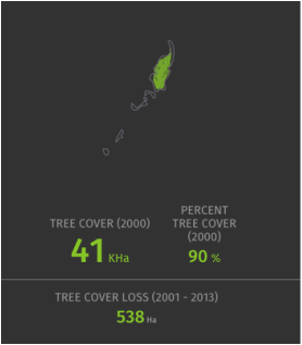
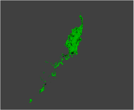
This map (top) further supports the high amount of forest cover that still remains intact.
Map courtesy of googlemaps/environmental |
Map courtesy of http://www.fs.fed.us/pnw/rma/fia-topics/state-stats/Palau/index.php 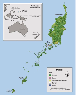
|
The topographical map displays the physical geography of Palau, providing a general layout of the last masses.
